
Walk 10: LOST ROADS & HIDDEN HOLWAYS
5.5km/3.4 miles approx. Allow 2 hours
'... some of the best local historians think that all history is to be found in documents of one sort of another. They completely overlook the visual evidence all around them, the evidence of their own eyes'. D G Hoskins
It has become apparent during 18 years' perambulations of Thorncombe parish's extensive network of footpaths, that many are survivals of an earlier road network. The following two hour walk draws on ongoing research into Thorncombe's history. Its route travels backwards and forwards through four thousand years linking fragments of prehistoric ridgeways, forgotten medieval holloways and lost roads.
Various footpaths in Thorncombe parish are survivals of an older road network. During
the late 18th century these lost roads provided alternative routes for travellers
wishing to avoid paying tolls to use the newly upgraded turnpiked roads. See Thorncombe's
Turnpike 1770-
Hollow ways, sunken lanes, were worn into the fabric of the landscape by countless pairs of feet, pack horses and herds of sheep, cattle, pigs and geese being driven to market. Thorncombe market dates back to 1313 and was closed in 1773 or thereabouts. The parish's neighbouring towns of Chard, Crewkerne and Axminster each had their own weekly markets and cattle fairs. They are all around 8 miles apart from Thorncombe. This is because under medieval law, markets had to be at least a day's walk apart, to and from, to protect local trade.
In this part of the world from the neolithic period onwards, farmers had winter and summer grazing grounds for cattle and sheep. Lush grass grown in the hills and valleys of Dorset provided winter grazing. Somerset gets its name from the rich summer meadows on what is now known as the Levels. Prior to their being drained, The Somerset Levels were flooded throughout the winter. Draining them began in the sixteenth century and still continues today. To reach the grazing and markets, drovers travelled along a combination of hollow ways and ridgeways which traced the course of rivers and streams between valleys along the tops and sides of hills. Ridgeways were the main trade routes until the end of the 17th century when new roads and canals started to be built. However ridgeways continued to be used by drovers until the coming of the railways in the 19th century.
FTip: walking from Thorncombe village to the beginning of the walk takes approximately
30 minutes. Alternatively, cars can be parked here in an informal lay-
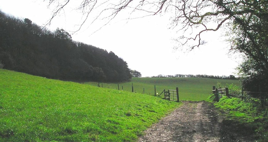
1. The walk starts beside the reservoir on Sadborow Road, a prehistoric ridgeway, from the gate next to the road where there is a footpath sign. Follow the footpath, noting the remaining few metres of parallel hedgebanks; part of the lost road to Marshallshay. When you reach the gate head diagonally across the field towards the gate in the right hand corner next to Grighay Farm, a Devon hall house, which dates back to the 17th century.
2. Turn left and take the second gate. Head for the gate beyond the oak tree, a waymarker. Look back from when you came and note several other oak trees marking the route of the old Marshallshay road. Keeping on wood on your right, head for the next gate and pass through it and the second gate ahead. Part of the old road runs parallel to this part of the footpath, among the trees.
3. Keeping the hedge on your right head for the next gate and pass through it. Hill View Farm is on your right. Follow the track towards the road at Birdsmoorgate.
4. Just before you reach the road there is a footpath behind Buckland Hill House. Climb over the stile here on to a short section of hollow way. This part of the walk follows the route of a prehistoric ridgeway linking Birdsmoorgate to Sadborow Road.
5. Pass through the gate, ignore the track on your right and keeping the holly hedge to your left pass through the gate and head for the stile in the far left hand corner of the field. Still keeping the hedge on your left, cross the next field, climb the stile and walk up the hill towards Paynes Down which is straight ahead.
6. Keep the fence on your left and climb the stile next to the gate. To your left is a circular plantation of beech trees. One of the Devil's Jumps, it is a local landmark. Scramble approximately 30 meters down the path from the stile to the track below. Turn left. The track takes you down to a gateway on Sadborow Road, opposite Paynes Down cottages. They overlook Racedown House across the valley, where the poet William Wordsworth and his sister Dorothy lived briefly between 1795 and 1797.
7. Turn right and follow Sadborow Road down to the Birdsmoorgate crossroads. The B3165, Lyme/Crewkerne Road was turnpiked in 1770 and unlike the Thorncombe branch earned its keep. See Brief History for details. The former Birdsmoorgate toll house, now called Eastcliff, is approximately 50 yards from the crossroads on the opposite side of the road going towards Marshwood.
8. Turn left and follow the B3165 to the footpath sign at Halscombe Bridge.
9. Follow the footpath to Castlewood Farm along the drive. Go through the kissing gate and keeping the fence to your left follow the footpath across the parkland. The path is now following the course of the River Synderford. Go through the gate into the wood and pass through the gate ahead into a field. Ignoring the gate on your left continue ahead into the next field until you reach a footbridge.
10. Go over the footbridge. Turn left and head for the stream. Cross at the ford.
11. Turn right and keeping the hedge on your left follow the path until you reach a good stretch of hollow way at Knacker's Hole.
12. Follow the hollow way until you reach a track. Ignore the track on your right and follow the track past the lakes on your left, ignoring the track on your left, continue ahead until you reach the road. The hollow way continues beside the footpath up to the road.
13. Turn right to retrace your steps to Thorncombe or turn left to go back to your parked car.
© EVE HIGGS
April 2015
REFERENCES
W.G. Hoskins, Local History in England (London: Longmans, 1972), 123.
Until the 1844 parliamentary boundary changes, Thorncombe was a detached part of Devon and part of the Axminster Hundred. It is now in West Dorset.
Ordnance Survey, First Series, Sheet 18 (1811) on-
British Library, Ordnance Survey Drawing OSD54 Beaminster (1806) on-
| History of the Trust |
| Constitution of the Trust |
| Minutes of meetings |
| Archived Minutes |
| Obituaries |
| Contacts |
| Newsletter |
| Newsletter Archives |
| Past Events |
| Blackdown Walk Aug 2013 |
| Bluebell Walk May 2013 |
| Pollinator Survey June 2013 |
| Visiting new-born lambs 2013 |
| 2014 Christmas Sale |
| Trees |
| Commemorative Trees |
| Johnson's Wood |
| Geology and geography |
| Wildlife |
| Birds |
| Chard Junction Nature Reserve |
| Nature Reserve pictures |
| Butterflies |
| Butterfly surveys |
| Photo albums |
| Artists and writers |
| Footpaths |
| General |
| Poor relief |
| Houses |
| In the news |
| Industry |
| Pubs |
| Religion |
| Reminiscences |
| Schools |
| 17th and 18th centuries |
| Harry Banks |
| Pissarro |
| Hedge Dating |
| Once upon a Thorncombe Road |
| Thorncombe's Lost Roads & Hidden Holways |
| Thorncombe's History |
| Thorncombe's Changing Boundaries |
| Parish Poorhouse and Workhouses |
| The poor |
| Life in Thorncombe's Workhouse |
| Chard St Bakery & Forge |
| Holway Cottage |
| Forde Abbey |
| Gough's Barton |
| Holditch Court |
| Upperfold House |
| Sadborow Hall |
| Wayside |
| Thomas Place and The Terrace |
| Pinneys |
| Dodgy local ice-cream |
| Gribb arsenic poisoning |
| Industrial relics |
| Westford Mill |
| Thorncombe's Flax and Hemp Industries |
| Broomstick Weddings |
| Royal Oak |
| Golden House |
| St Mary's Church |
| Thorncombe's Chapels |
| Quakers |
| Commonwealth vicars |
| Who was William Bragge? |
| Holditch memories |
| St Mary's School |
| St Mary's School photos |
| Forgotten epidemic |
| Jacobites |
| Walk 1 |
| Walk 2 |
| Walk 3 |
| Walk 4 |
| Walk 5 |
| Walk 6 |
| Walk 7 |
| Walk 8 |
| A Village Walk. Walk 9 |
| Walk 10 |
| Rights of Way information |